ThinkGeo Maps Query Sample Spotlight: Cities Affected by Nuclear Disasters
There have been a handful of nuclear power plant events that have had significant consequences for people, the environment and the facilities and workers of the plant. Sometimes the scope and radius of the area impacted by these events is minimized or not completely understood. Maps can help in painting that picture. ThinkGeo Cloud can go the extra mile and stress the importance and the magnitude of such events.
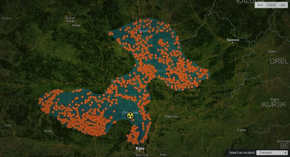
ThinkGeo’s Maps Query Service can be used in a near-limitless variety of applications, but for this use case we wanted to show off the ease of putting a map together that focuses on finding points within a custom area shape. As a result, we have our “Cities Affected by Nuclear Accidents” map/sample that showcases the areas impacted by radioactive fallout from three major historical nuclear reactor accidents of the last fifty years: The Chernobyl disaster of 1986; the Three Mile Island accident of 1979 and the Fukushima Daiichi meltdown of 2011.
Using the ThinkGeo Cloud Maps Query service, this sample identifies all of the cities, towns, villages and settlements that were affected by elevated levels of radiation in the aftermath of these disasters. Clicking on any of these will show you the name (in both the native language and Romanized English) and classification of that town. This is just one example of how you can use the ThinkGeo Cloud to quickly answer questions like who might be affected by a looming natural disaster, weather event or man-made accident.
Get hands on with our Nuclear Fallout sample through ThinkGeo’s Demo Center now and if you’d like to build your own visual using ThinkGeo Maps and our Maps Query service then get your free 60-day evaluation of ThinkGeo Cloud started today!