Maritime Map Developer? Check out the Nautical Charts Extension!
The new ThinkGeo Nautical Charts Extension is a great tool for any .NET developer who needs to create or view desktop or web maps that display NOAA’s Electronic Navigational Charts which conform to the International Hydrograph Office (IHO) S-57 international exchange format as defined in the special publication S-52. Use the Nautical Charts Viewer, which is used in conjunction with ThinkGeo’s Map Suite for Desktop or Web Editions, to view any ENC in S-57 format.
Check out the “ENC Viewer for Displaying S-57 Data” sample that can be downloaded from the ThinkGeo Wiki under “Code Samples” on the appropriate Map Suite Edition. Before you install the Nautical Charts Extension, make sure you have the latest development branch daily build of the Map Suite Edition you’re using, which can be found on the right side of the Product Center “Overview” screen.
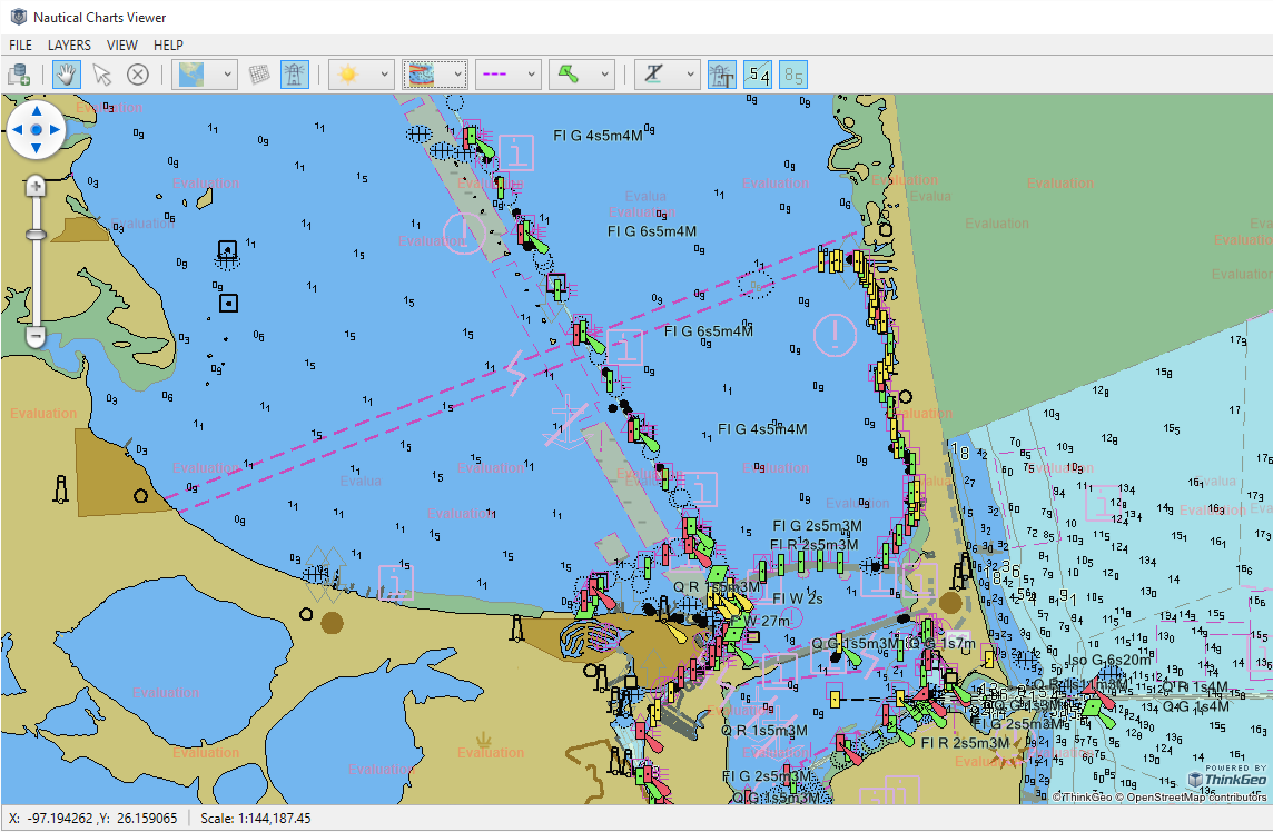
After downloading the ENC Viewer code sample, run the solution in Visual Studio. ThinkGeo’s Nautical Chart Viewer will appear. Download sample ENCs from NOAA’s website, or use your own S-57 data. Use File -> Open to load the data. The Nautical Chart Viewer will ask to generate an index file the first time the data is loaded. The extent of the data will appear within the bounding box that was listed on the load screen.
To navigate in the Nautical Chart Viewer, click and drag to pan. To zoom, use the mouse scroll wheel or hold down shift and draw a box.
ThinkGeo uses a default style to render the data. You can change the color scheme by clicking on the “sun” icon in the toolbar. By default, all features are displayed. To hide features, click the icon to the right of the “sun” icon. Dashed lines are used by default for boundaries, but you can select symbolized boundaries from the toolbar. Simplified or Paper Chart symbols are available. English labels are the default, but you can select National Language if your S-57 data has an alternate language. There are also options to show or hide Light Descriptions, Contour Labels, and Sounding Labels. All of these options can also be set on the View Menu.
If you are a .NET developer using the Map Suite Controller, these features are able to be turned on and off in the code. Feel free to customize any of the Nautical Chart Extension classes to your liking. Extensibility is one of the core strengths of ThinkGeo’s Map Suite.