Reverse Geocoding in ThinkGeo Cloud
Knowing where you are and what’s around you was once an area only experts and roadmaps could help you with. In the last 20 years it’s safe to say a mapping revolution has taken place and now typing in what you’re looking for near you is commonplace. ThinkGeo Cloud’s Reverse Geocoding API lets you quickly convert coordinates from anywhere in the world into human-readable streets addresses. It also allows users to get a list of nearby points of interest and to find the nearest place of any category you want; again with global coverage.

Our basic reverse geocoding capabilities are publicly accessible on our ThinkGeo World Map; start by clicking on the picture above then zoom in to any area anywhere on the map and right click to select [Search Nearby] and you’ll be presented with immediate results that can be filtered into further subcategories. You can also get hands-on with our Reverse Geocoder via our embedded website demo.
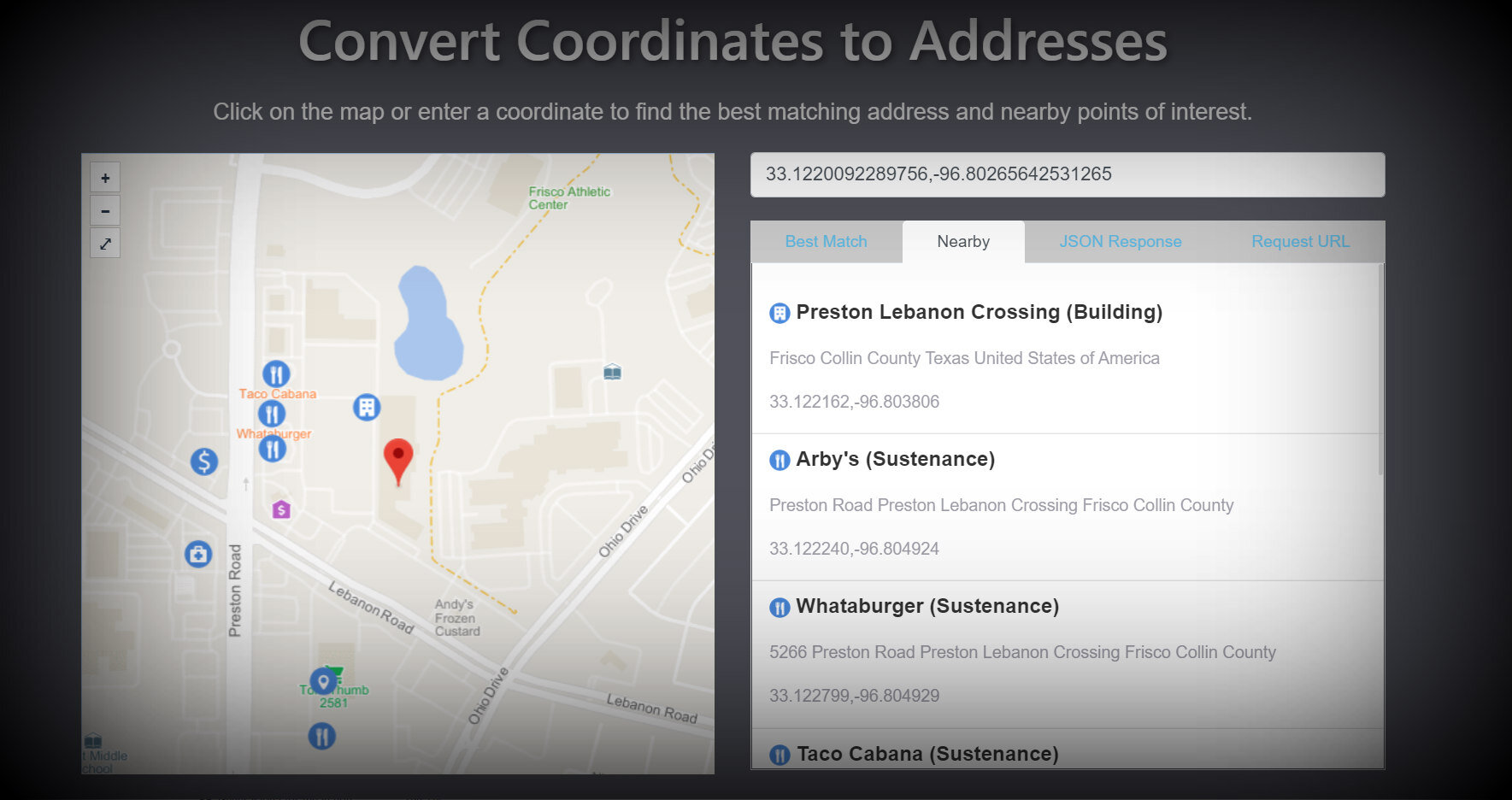
Batch handling, high speed results, the ability to filter your results by type and receiving the distance/direction information between the search place and a specific nearby result are just a handful of the advantages that ThinkGeo Cloud’s Reverse Geocoder can provide you. We encourage you to start building with a free 60-day ThinkGeo Cloud evaluation that grants you access to all of our Cloud APIs so you can see the difference for yourself.