What is Geocoding and Reverse Geocoding?
If you are new to GIS you may not be familiar with the terms geocoding and reverse geocoding, but it’s likely you have done some sort of geocoding without being aware of it. Geocoding is the process of taking an address or location and converting it to latitude and longitude. Have you ever searched for an address on Google Maps or any other mapping application? If so, you geocoded! There may be several reasons why you need to geocode, but these are some of the more common applications: finding addresses, plotting customer locations, or plotting locations to get route information. All these tasks require some form of geocoding. For a more in-depth explanation of geocoding and the available techniques visit the Geocoding Wikipedia article.
Reverse geocoding is the opposite process that takes a latitude and longitude and converts it to an address or place such as (City, State, County, Zip etc.). Coordinates alone doesn’t make much sense to us; therefore we must reverse geocode them into an address or a physical location. Reverse geocoding is commonly used within Emergency services, GPS tracking systems or any other location-based application. For example when you place a 911 call, first responders are able to see you address location be reverse geocoding the coordinates provided by the GPS chip on your phone. More details about reverse geocoding can be found here.
Common terms associated with geocoding and reverse geocoding are bulk and/or batch geocoding. These terms are used when processing large amounts of data stored in some sort of database. Many geocoding software or APIs may offer this feature.
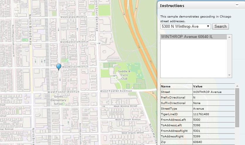
Map Suite Geocoder is a .NET component that allows developers to build custom geocoding and reverse geocoding apps. Whether you want to build a standalone application or want to create a custom geocoding web services Map Suite Geocoder gives you all the necessary APIs. Visit the Chicago geocoder online demo to review some of the geocoder features or download the sample app from GitHub to start your free evaluation today.