
ThinkGeo Basics: Styles
This week’s post is the second in a series of ‘ThinkGeo Basics’ that will dive into the fundamentals of building your own mapping solution. Today’s post will explore how Styles work in ThinkGeo.
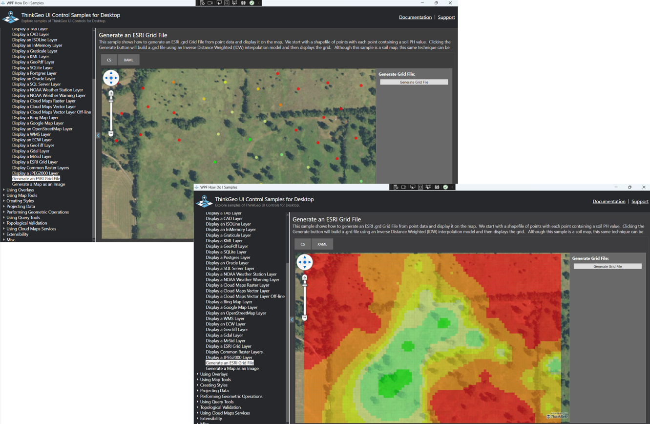
Generating Grid Files
Today’s blog post introduces a new ‘HowDoI’ sample that demonstrates how to generate and display an ESRI Grid File from point-based data.


‘How Do I’ Samples Now on the App Store & Play Store
ThinkGeo Mobile samples are now available on the Apple App Store and Google Play Store. Check them out today!

ThinkGeo Basics: Feature Sources
This week’s post is the first in a series of ‘ThinkGeo Basics’ that will dive into the fundamentals of building your own mapping solution.

Measuring Distance and Area
In this week’s blog post, we’re reviewing an often overlooked feature that allows for the easy measuring of distances and areas.


Display SQLite Data in WPF
In this article we will show you how to simply create a map using SQLite in Wpf.
Display Maps in .NET 5 WPF Using VS Code
This article will cover how to simply create a desktop WPF map application in .NET 5 using VS Code.
Display Shapefiles in WPF
In this article, we will cover how to create an application that shows you how easy it is to display shapefiles in WPF using ThinkGeo Desktop Maps.