Add Spatial Querying Capabilities to Your Maps
Have you considered using GIS to make spatial decisions? Spatial querying is a powerful tool that helps you make decisions based on geographic relationships between different features. You might be wondering why you would want to use spatial queries. Some good examples of spatial querying might be the need to know the coverage area for a Wi-Fi system or the proximity of possible hazardous materials to schools so that plans can be made accordingly and much more.
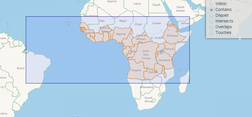
There are several types of spatial queries available to you:
Within – Selects features that the querying feature fully contains.
Contains – The inverse of within, it returns the feature that fully contain the querying feature.
Disjoint – Selects features that are fully outside the querying feature.
Intersecting – Selects only the features that intersect with the querying feature.
Overlaps – Selects only the features that overlap the querying feature.
Touching – Selects all features that touch the querying feature.
You can see the interactive demo here. The spatial querying APIs are available in the Map Suite core so no matter what type of app you are building we have you covered.