Routing Cost Matrix API added to ThinkGeo Cloud
Sometimes getting from point A to point B just isn’t enough. Sometimes there are points C-Z to factor into consideration and if that’s the case then odds are you need to know how long it’s going to take to get there too. Enter ThinkGeo’s Routing Cost Matrix API. This latest addition to our ThinkGeo Cloud arsenal introduces a simple service that calculates the time and/or distance between several waypoints.
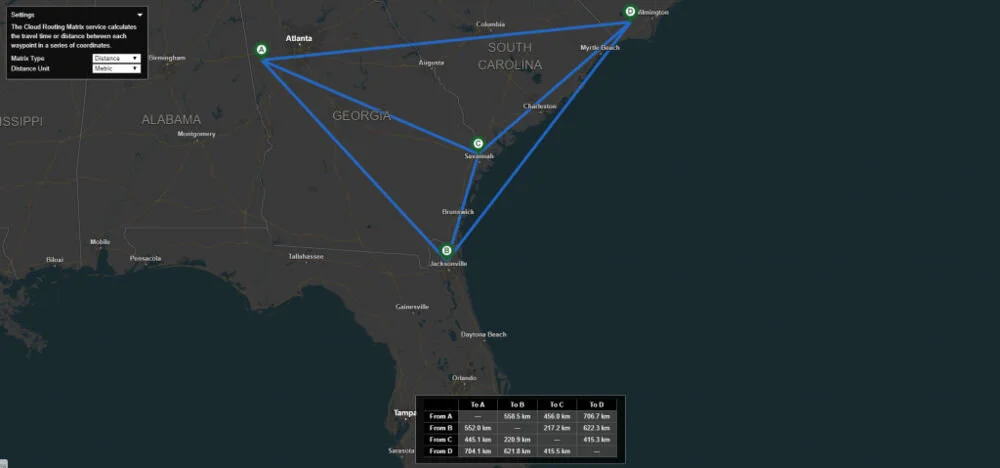
In the visual above we’ve generated a matrix of driving distances between four points we selected on the map. If you’re more interested in trip duration, you can set the matrix type to “Time” so as to determine the amount of driving time needed between each point. Both of these factors are crucial in emergency dispatch, disaster relief and other reactionary businesses/trades.
Fleet management is another obvious use case for an API of this nature. If my hub is in Dallas and I have trucks delivering good to various Midwest locations, I’ll want to know how long each truck will take to reach its destination. The travel distance will help me optimize that truck’s next delivery point and I’ll have the numbers on my side in doing so.