New Code Sample: Label Point with Circle Symbol and Mask Description
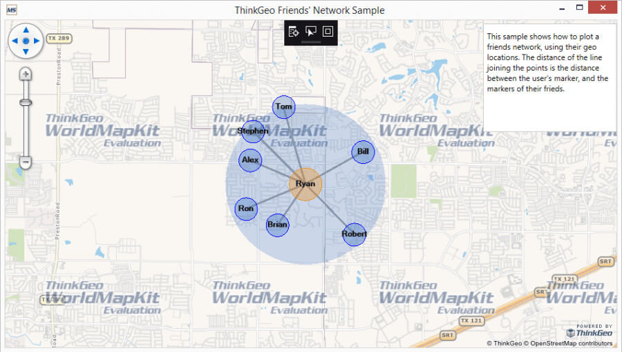
A new project has been created based on customer demand. This sample demonstrates how you can create a friends network using geolocations. It uses a combination of styles and labeling allowing you to show points and distances between friends.
If you are a developer looking to build a GIS app that requires geolocation mapping you can try out Map Suite for free by downloading the sample from GitHub. This sample is fully customizable and allows developers to jump-start their GIS project